A Must-Use Resource for Homebuyers and New Residents
If you’re planning to move to Charlotte or anywhere in Mecklenburg County, North Carolina, you’ll want to check out one of the region’s most valuable online tools: the Mecklenburg County GIS system. Whether you’re researching neighborhoods, evaluating properties, or just getting to know the area, this powerful platform provides access to maps, data, and layers of local information—all from your browser.
🗺️ What Is GIS and Why Does It Matter?
GIS stands for Geographic Information System. It’s a digital mapping tool that helps users view, analyze, and interact with spatial data. Mecklenburg County’s GIS system goes far beyond basic maps—it integrates detailed property records, zoning information, environmental data, and more, giving users a bird’s-eye view of everything from lot sizes to flood zones.
🔍 Key Tools Available at GIS.MECKNC.GOV
Mecklenburg County’s GIS portal is incredibly user-friendly, with several focused applications designed for different types of searches. Here are a few of the most useful tools:
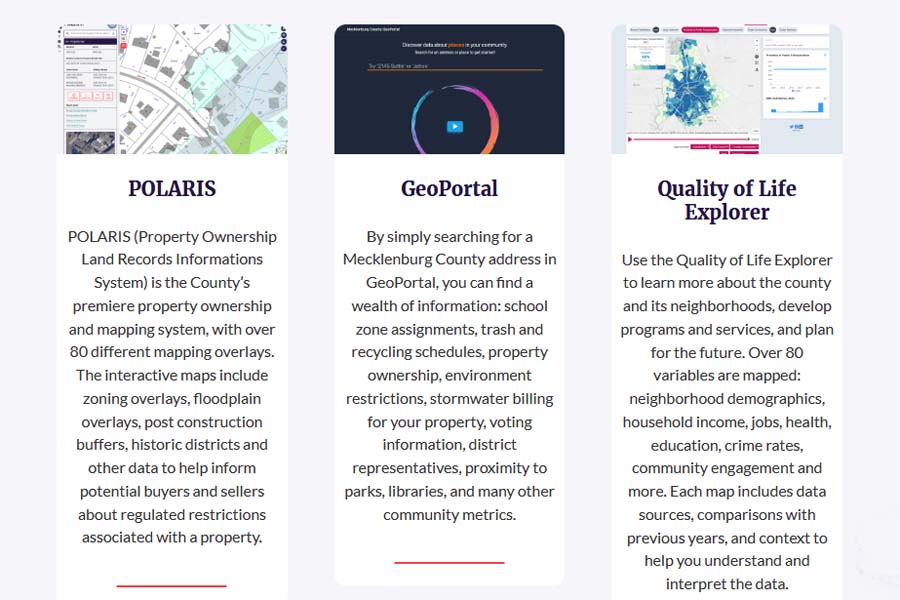
1. Polaris 3G
This is the go-to map for property and ownership details. With Polaris 3G, you can:
- Look up any property by address, owner name, or parcel number
- See real estate boundaries, tax values, and building details
- Access sales history, deed info, and zoning codes
Perfect for: homebuyers, real estate agents, and property investors
2. GeoPortal
This modern interface allows for custom mapping with layers like:
- School districts
- Voting precincts
- Parks and greenways
- Floodplains and stormwater infrastructure
Perfect for: families researching schools, outdoor lovers, and those assessing environmental risks
3. Historic Aerials Viewer
Want to see how your neighborhood has evolved over time? The Historic Aerials Viewer provides decades of satellite imagery for Mecklenburg County.
4. Crime Mapping Tool (via CMPD)
While not hosted on the GIS portal itself, this tool integrates with GIS to provide real-time crime data by neighborhood.
🏡 How This Helps You as a Homebuyer or New Resident
Using Mecklenburg County’s GIS tools, you can:
- Research neighborhoods before committing to a move
- Check flood zones and zoning rules before buying land or renovating
- Verify ownership and tax value of a property you’re considering
- Evaluate proximity to schools, parks, and emergency services
- Understand long-term development trends in the area
🌐 Get Started
Here’s a quick list of links to get you exploring:
Whether you’re a first-time homebuyer or relocating for work, understanding the landscape—literally—can give you a major advantage. Mecklenburg County’s GIS tools are free, easy to use, and packed with insight.
If you’d like a walkthrough on how to use any of these tools for a specific property or area, just let me know!
Full Advanced Search
Editor's Pick
What Our Customers Say
“I went under contract on my home, one hour after he listed the property.”
"Brent Dillon is the reason that the process of selling of my home and buying a new home in Florida went flawlessly. Brent was there every step of the way, guiding me and making me [...]


